Home · Sights · The Jonction, Where the Rhône Meets the Arve
The Jonction, Where the Rhône Meets the Arve
- IThe two colorsTurquoise water from Lake Geneva beside gray glacial water from the Arve, running side by side
- IIThe pointThe tip of land where the rivers meet, with river bathing platforms and a summer buvette
- IIIThe viaductA railway and footbridge of 1941–1945 just downstream, the classic place to see the colors
- IVThe ArveA river rising on the northern side of the Mont Blanc massif, fed by its glaciers
- VThe hidden dikeAn underwater dividing wall built to keep the Arve's gravel from spreading into the Rhône
From darkness to light
Why it matters
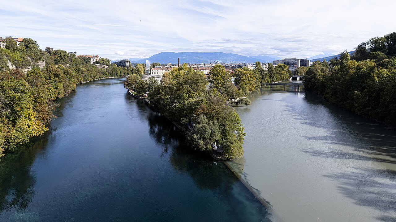
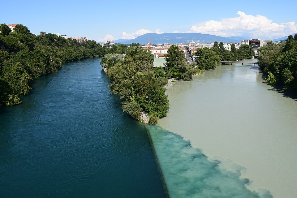
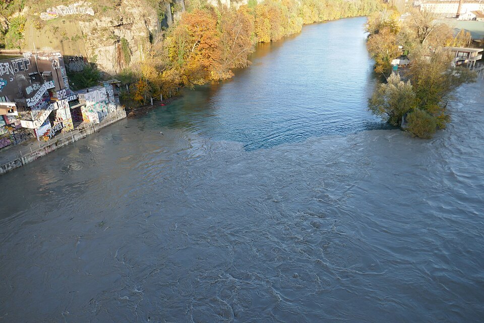
Most rivers meet quietly. At Geneva's Jonction, two very different rivers run side by side for a long way before they finally mix, and the line between them is visible from the bridges above: on one side the clear, turquoise Rhône that has just come out of Lake Geneva, on the other the milky gray Arve, loaded with the silt of the Alpine glaciers.
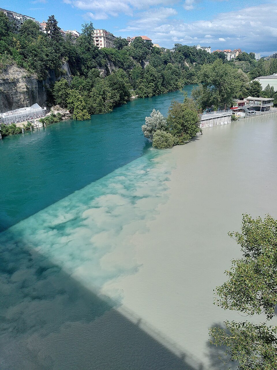
The contrast has a simple explanation. The Rhône leaves Lake Geneva with little sediment in it, while the Arve comes down from the Mont Blanc massif carrying the alluvium that turns it gray. The difference in density between the two waters, and their separate currents, keep them apart after they meet.
It is one of the most striking natural sights inside the city, and in summer it is also a favorite spot of Genevans, who come to swim in the Rhône and set off from here in kayaks and rafts.
The two rivers
The Rhône enters Lake Geneva in the Valais and leaves it in the middle of Geneva, a few hundred meters from the Jardin Anglais. By the time it reaches the Jonction it has passed under the city's bridges and through the Seujet dam, built in 1995 to regulate the level of the lake and the flow of the river and to produce electricity; the dam has a fish ladder and even a wooden passage for beavers.
The Arve is a river of the mountains. It rises on the northern side of the Mont Blanc massif, close to the Swiss border, gathers the water of the glaciers on the French side of the massif, including the Mer de Glace, and flows down through the valleys of Haute-Savoie before entering the canton of Geneva. Of its 108 kilometers, only the last nine are in Switzerland.
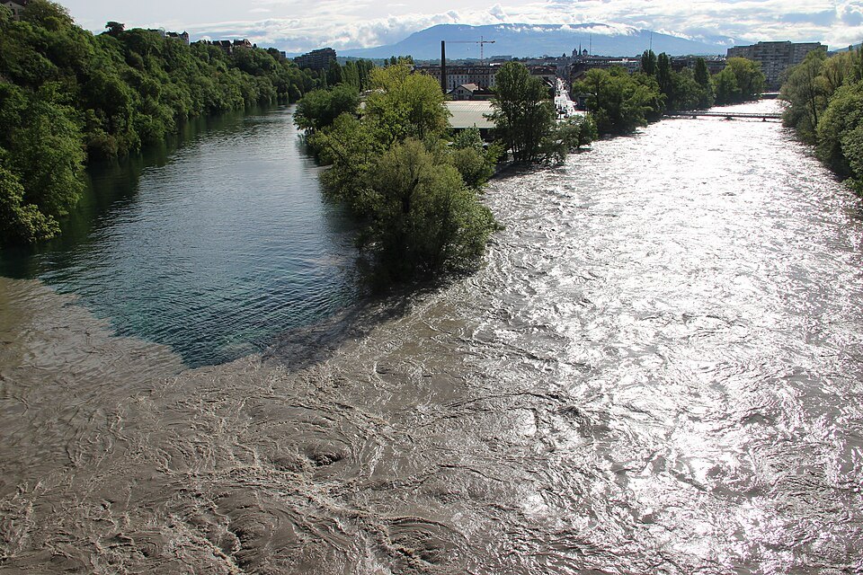
It is also a river that floods. In exceptionally violent floods the Arve has pushed its water back up the Rhône toward the lake and made the mills of Geneva turn backward, as happened in 1527, 1570, 1651, 1673, 1711 and 1888. In May 2015 and again in the flood of November 2023, which counted as a once-in-a-century event, the authorities declared the highest level of danger.
What you actually see
The best view is from the Viaduc de la Jonction, a railway and pedestrian bridge built between 1941 and 1945 to take the tracks from Cornavin station to the freight yards on the far side of the Arve. It spans the Rhône just below the confluence, between the Saint-Jean district on the right bank and the woods of the Bois de la Bâtie on the left, and it now carries the trains of the Léman Express.
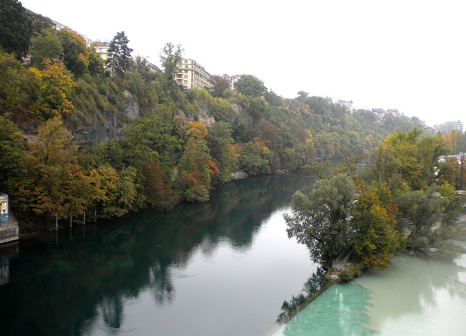
From the walkway you look straight down on the meeting of the waters: the Rhône's blue-green channel along one bank, the Arve's gray stream along the other, and a clean, wavering line between them that runs far downstream. The contrast is strongest when the Arve is carrying the most meltwater and silt.
The meeting is natural, but people have reinforced it. A submerged dividing dike was built at the confluence to stop the gravel and sand carried by the Arve from being dumped into the Rhône.
At the tip of the peninsula itself, the Pointe de la Jonction, wooden platforms let swimmers rest between dips in the Rhône, and in summer a buvette and deckchairs are set up for them.
The district behind the point
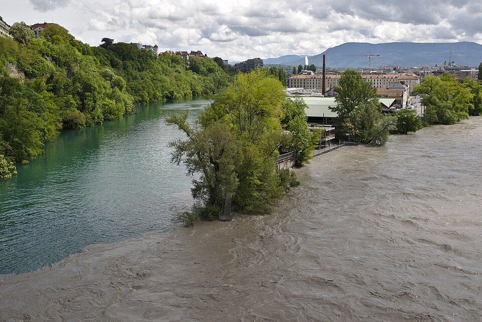
The Jonction district takes its name from the confluence. Until the city spread over it at the end of the nineteenth century it was an area of market gardens between the two rivers, and street names still recall them: the Rue des Jardins, and the Rue des Plantaporrêts, the street of the leek planters, where Lenin lived during his exile in Geneva.
In the twentieth century the Jonction became industrial, with the gasworks and precision engineering firms. Today its former industrial buildings have become cultural spaces, among them L'Usine and the Bâtiment des Forces Motrices, and the district holds the Musée d'ethnographie, the contemporary art museum Mamco on a street much loved by galleries, and the tower of the Swiss public broadcaster, built in 1969, near the Uni Mail building, one of the largest sites of the University of Geneva.
How to visit
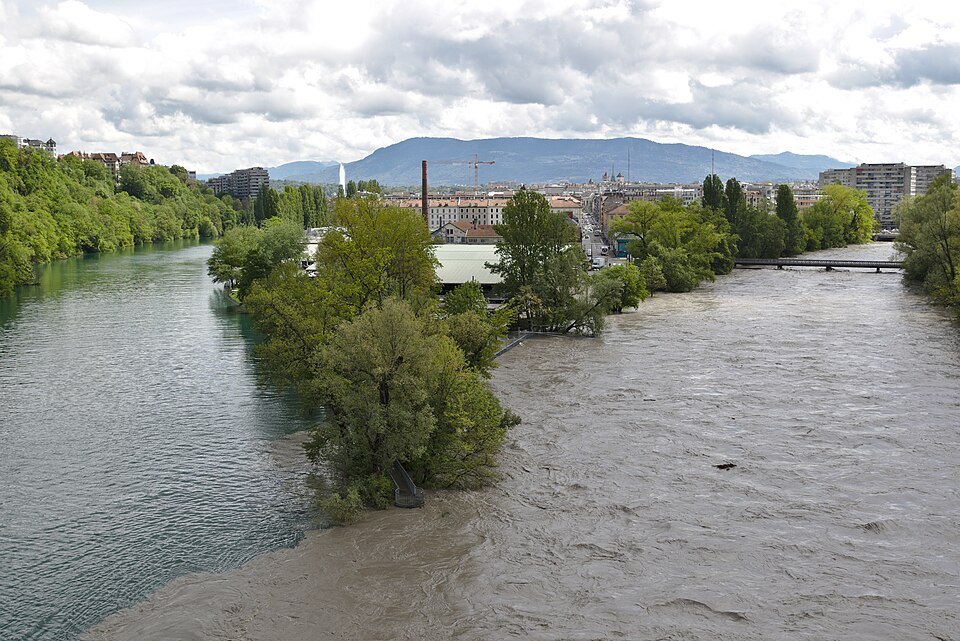
It is a walk of about half an hour along the Rhône from the Pont de la Machine, or a short tram ride toward the Jonction followed by a few minutes on foot to the point. Allow an hour to walk out, cross the viaduct and look at the rivers from both sides.
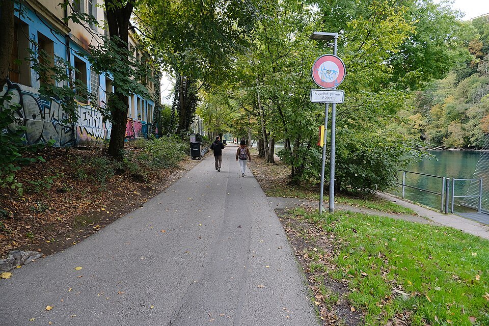
The path along the Rhône toward the Jonction is pleasant in its own right, passing the Bâtiment des Forces Motrices, one of the old industrial buildings of the district that have become cultural venues.
Swimming in the Rhône is a local habit, but the current is strong and the Arve, gray with glacial water, is another matter altogether. If you want to swim, do it where the city has set up platforms for bathers and follow the posted advice.
Nearby
- A few steps awayÎle Rousseau and the Pont de la MachineThe first stretch of the Rhône after it leaves Lake Geneva: an old bastion turned island garden with Rousseau's statue, a suspension-bridge site of 1834, and the city's oldest bridge over a vanished water machine.Read the page
- A few steps awayPlace de Neuve and the Grand ThéâtreThe square laid out where Geneva's western gate was pulled down in 1853, ringed by the opera house, the music conservatory and the old museum of fine arts, with General Dufour on horseback in the middle.Read the page
- A few steps awayThe Jardin Anglais and the Flower ClockGeneva's first English-style park, created in the 1850s on land won from the lake, with the flower clock of 1955, the National Monument, a cast-iron fountain and the harbor's two glacial boulders offshore.Read the page